We are hiring 2 full-time positions! Applications due Aug. 16, 2026
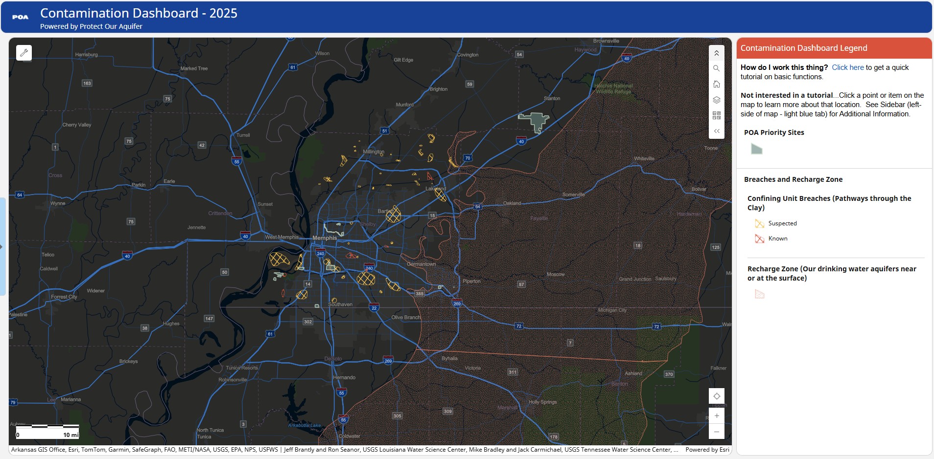
What sites of concern are in my neighborhood? Is there a breach nearby? Am I in the recharge zone? The answer to these questions is just one click away!
You've asked so many good questions over the years, we wanted to give you another tool to help you in protecting your water resources and your community. This is an ever-evolving work in progress which, with your help, will become a community-driven environmental digital library.
The data displayed here is from a variety of sources including the Tennessee Department of Environment and Conservation (TDEC), the U.S. Environmental Protection Agency (EPA), and the U.S. Geological Survey (USGS) as well as research from the University of Memphis. We have compiled all of this information in one place so you can see how environmental concerns at the surface relate to the Aquifer below your feet.
Just to let you know...Location and boundaries are based on agency sources and may contain errors. Data created by Protect Our Aquifer is based on best available information and sources are cited in the metadata. All data are publicly accessible and should be credited appropriately.
Did we miss something? Or didn't get something quite right? Do you want to share your data? Or just have a question? Please Contact Us.
Feel free to download data as needed or explore the original sources (see Supporting Content section below). We plan to update all federal and state databases every spring. So if you need the most recent data...go to the source.
New Updates (11.21.25) -- Added TDEC TN Clean Site Story Maps to West TN Remediation Sites including Boone Dry Cleaners (Jackson), Creotox (Memphis), Chromasco (Memphis), John Little Drum (Memphis), Henry County Boneyard (Paris), Fiberfine (Memphis), and Chapman Chemical (Memphis). Check them out, they are really well done.
New Updates (3.12.26) --
SLOWLY adding Tenn. Geological Survey surface geology quadrangles in West TN including Adair, Alamo, Bells, Bonicord, and Westover. Find the quadrangles under the Geology (The really cool stuff!). More will be added soon!
Added EPA Underground Storage Tanks (2019) for entire U.S.
Added PFAS Raw Water Results in Public Water Supply Systems in West Tennessee.
Added Cypress Creek Soil Data (Dieldrin and Total Pesticide concentrations)
Added Velsicol (Memphis) Carbon Tetrachloride Plume (2022)
New Updates (5.29.26) --
Available shapefiles of West TN Geological Quadrangles posted.
How do I work this thing? Click here to get a quick tutorial on basic functions.
Need to print? Click here for a tutorial.
What do the layers and symbology mean?


